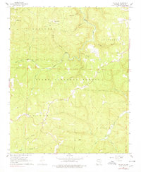
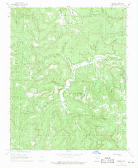
1967 Map of Fallsville
USGS Topo · Published 1978About this map
Fallsville serves as a central hub in this high-elevation corner of the Ozark National Forest, where the headwaters of the Buffalo River and Big Piney Creek begin their descent. Surveyed in the mid-1960s and inspected in 1975, the map reveals a landscape defined by deep hollows and high points like Turner Ward Knob, which stood near the Buffalo Lookout Tower. Small family and community landmarks are scattered throughout the difficult terrain, including the Cassville Ch and several isolated burial sites such as Sullivan Cem and Kapark Cem. The topography underscores the isolation of these Ozark settlements, connected by winding routes that follow ridgelines and creek beds like Main Prong Big Buffalo Creek. An old Quarry near the Boston township line suggests localized resource extraction during an era when timber and small-scale agriculture dominated the regional economy.
Find a feature on this map
35 named features on this map. Tap any name to fly to it.
Don’t see what you’re looking for? This feature index may not catch every label — zoom into the map to look around manually.
Map Details
Editions of this 1967 Fallsville Map
3 editions found
Other maps of this area

1889 · Ozone
USGS Topo · 1:62,500

1906 · Batson
USGS Topo · 1:62,500

1934 · Ozone
USGS Topo · 1:62,500

1936 · Ozone
USGS Topo · 1:62,500

1956 · Russellville
USGS Topo · 1:250,000

1964 · Russellville
USGS Topo · 1:250,000
1967 · Fallsville
USGS Topo · 1:24,000
1968 · Swain
USGS Topo · 1:24,000
1968 · Murray
USGS Topo · 1:24,000
1968 · Boxley
USGS Topo · 1:24,000