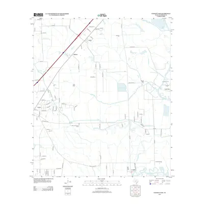
2013 Map of Fannett East
USGS Topo · Published 2013About this map
Fannett and La Belle anchor this coastal Texas landscape, where a dense network of water management features like the Gallier Canal and Jefferson Canal underscores the region's agricultural and industrial reliance on water control. The southeastern corner is defined by the extensive Lovell Lake Oil Field, signaling the importance of energy extraction alongside established settlements. Genealogists and local historians can locate several family-named burial sites, including Broussard Cem, Landrum Cem, and Hillebrandt Cem, which are scattered throughout the low-lying terrain. The map's drainage patterns are complex, featuring Willow Marsh Bayou, Bayou Din, and Taylor Bayou, which wind between rural holdings and smaller communities like Cheek and Galloway. Transport and utility infrastructure is evident through the presence of the Kelley Crop Service Airport, serving the local rice and crop fields that have long characterized this portion of Jefferson County.
Find a feature on this map
92 named features on this map. Tap any name to fly to it.
Don’t see what you’re looking for? This feature index may not catch every label — zoom into the map to look around manually.
Map Details
Editions of this 2013 Fannett East Map
This is the sole edition of this map. No revisions or reprints were ever made.
Other maps of this area

1926 · Vidor
USGS Topo · 1:24,000

1932 · Beaumont
USGS Topo · 1:62,500

1943 · Fannett East
USGS Topo · 1:24,000

1943 · Beaumont East
USGS Topo · 1:24,000

1945 · Fannett East
USGS Topo · 1:31,680

1950 · Houston
USGS Topo · 1:250,000

1954 · Beaumont
USGS Topo · 1:250,000

1955 · Sour Lake
USGS Topo · 1:62,500

1956 · Houston
USGS Topo · 1:250,000

1957 · Beaumont
USGS Topo · 1:250,000