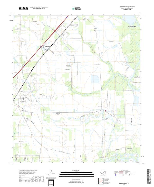
2022 Map of Fannett East
USGS Topo · Published 2022About this map
Taylor Landing and the surrounding marshlands south of Beaumont characterize this coastal Texas landscape, where a complex network of bayous and man-made waterways support the region's agricultural and drainage needs. Significant water features like Taylor Bayou and Willow Marsh Bayou define the terrain, interspersed with settlements such as Cheek and Fannett. The agricultural heritage of Jefferson County is evident in infrastructure like the Kelley Crop Service Airport and the extensive Gallier Canal. For those researching local families, the map provides precise locations for several burial grounds, including Lincoln Park Cem, Landrum Cem, and Hillebrandt Cem. The presence of the Jefferson Canal and numerous named gullies such as Kidd Gully and Peytot Gully illustrates how water management has historically shaped the development of these communities between the bayous and Lovell Lake.
Find a feature on this map
86 named features on this map. Tap any name to fly to it.
Don’t see what you’re looking for? This feature index may not catch every label — zoom into the map to look around manually.
Map Details
Editions of this 2022 Fannett East Map
This is the sole edition of this map. No revisions or reprints were ever made.
Other maps of this area

1926 · Vidor
USGS Topo · 1:24,000

1932 · Beaumont
USGS Topo · 1:62,500

1943 · Fannett East
USGS Topo · 1:24,000

1943 · Beaumont East
USGS Topo · 1:24,000

1945 · Fannett East
USGS Topo · 1:31,680

1950 · Houston
USGS Topo · 1:250,000

1954 · Beaumont
USGS Topo · 1:250,000

1955 · Sour Lake
USGS Topo · 1:62,500

1956 · Houston
USGS Topo · 1:250,000

1957 · Beaumont
USGS Topo · 1:250,000