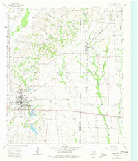
1962 Map of Farmersville
USGS Topo · Published 1980About this map
The railroad crossing at Farmersville serves as the focal point of this North Texas landscape, where the Gulf Colorado and Santa Fe meets the Louisiana and Arkansas line. This junction established the town as a regional shipping hub, evidenced by the dense grid of streets and municipal infrastructure including the Wofford Sch and several large cemeteries like Twin Cemetery. To the northeast, the smaller settlement of Merit sits near the Collin and Hunt County line, surrounded by a network of family-named landmarks and rural institutions such as the Highmound Park Training Track and Tatum Ch.
Find a feature on this map
33 named features on this map. Tap any name to fly to it.
Don’t see what you’re looking for? This feature index may not catch every label — zoom into the map to look around manually.
Map Details
Editions of this 1962 Farmersville Map
Other maps of this area

1924 · Farmersville 3-c
USGS Topo · 1:48,000

1930 · Farmersville
USGS Topo · 1:62,500

1954 · Sherman
USGS Topo · 1:250,000

1958 · Sherman
USGS Topo · 1:250,000

1960 · Blue Ridge
USGS Topo · 1:24,000

1960 · Pike
USGS Topo · 1:24,000

1960 · Culleoka
USGS Topo · 1:24,000

1962 · Greenville NW
USGS Topo · 1:24,000

1962 · Greenville SW
USGS Topo · 1:24,000

1962 · Farmersville
USGS Topo · 1:24,000