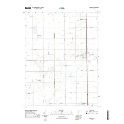
2018 Map of Farmersville
USGS Topo · Published 2018About this map
Farmersville serves as the central hub of this Central Illinois landscape, where the grain-handling infrastructure along Elevator St reflects the region's enduring agricultural focus. The map illustrates the boundary between Macoupin Co and Montgomery Co, a line that runs through a terrain defined by the winding paths of Horse Cr and Macoupin Cr. To the north, the small settlement of Thomasville sits near the headwaters of W Br Horse Cr, while Waggoner occupies the southern edge of the survey.
Find a feature on this map
60 named features on this map. Tap any name to fly to it.
Don’t see what you’re looking for? This feature index may not catch every label — zoom into the map to look around manually.
Map Details
Editions of this 2018 Farmersville Map
This is the sole edition of this map. No revisions or reprints were ever made.
Other maps of this area

1922 · Divernon
USGS Topo · 1:62,500

1923 · Carlinville
USGS Topo · 1:48,000

1923 · Raymond
USGS Topo · 1:62,500

1924 · Divernon
USGS Topo · 1:62,500

1924 · Waverly
USGS Topo · 1:62,500

1925 · Carlinville
USGS Topo · 1:62,500

1925 · Raymond
USGS Topo · 1:62,500

1926 · Waverly
USGS Topo · 1:62,500

1931 · Carlinville
USGS Topo · 1:62,500

1958 · Decatur
USGS Topo · 1:250,000