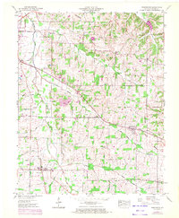
1951 Map of Farmington
USGS Topo · Published 1972About this map
Mayfield serves as the industrial and civic anchor in the northwest corner of this quadrangle, featuring the Woolen Mill and the College Street Sch. The landscape is defined by the Tennessee Valley Divide, which cuts through the undulating terrain where small communities like Sedalia and Farmington developed along the road network. Agricultural life is evident in the numerous family-named landmarks and rural congregations, such as Chapel Hill Church and Bethel Ch, which are scattered between the drainages of Mayfield Creek and Little Mayfield Creek.
Find a feature on this map
34 named features on this map. Tap any name to fly to it.
Don’t see what you’re looking for? This feature index may not catch every label — zoom into the map to look around manually.
Map Details
Editions of this 1951 Farmington Map
3 editions found
Other maps of this area

1936 · Farmington
USGS Topo · 1:24,000

1936 · Oak Level
USGS Topo · 1:24,000

1936 · Lynn Grove
USGS Topo · 1:24,000

1936 · Benton
USGS Topo · 1:48,000

1936 · Westplains
USGS Topo · 1:24,000

1936 · Kirksey
USGS Topo · 1:24,000

1951 · Kirksey
USGS Topo · 1:24,000

1951 · Farmington
USGS Topo · 1:24,000
1951 · Oak Level
USGS Topo · 1:24,000

1951 · Hickory
USGS Topo · 1:24,000