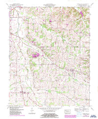
1951 Map of Farmington
USGS Topo · Published 1988About this map
Mayfield sits at the western edge of this landscape, where the Woolen Mill and East College Street Sch reflect the town's mid-century community life. The terrain is defined by the Tennessee Valley Divide, a natural ridgeline that separates the drainage of numerous local waterways, including the winding Mayfield Creek and its many tributaries like Little Mayfield Creek and Red Duck Creek.
Find a feature on this map
30 named features on this map. Tap any name to fly to it.
Don’t see what you’re looking for? This feature index may not catch every label — zoom into the map to look around manually.
Map Details
Editions of this 1951 Farmington Map
3 editions found
Other maps of this area

1936 · Farmington
USGS Topo · 1:24,000

1936 · Oak Level
USGS Topo · 1:24,000

1936 · Lynn Grove
USGS Topo · 1:24,000

1936 · Benton
USGS Topo · 1:48,000

1936 · Westplains
USGS Topo · 1:24,000

1936 · Kirksey
USGS Topo · 1:24,000

1951 · Kirksey
USGS Topo · 1:24,000

1951 · Farmington
USGS Topo · 1:24,000
1951 · Oak Level
USGS Topo · 1:24,000

1951 · Hickory
USGS Topo · 1:24,000