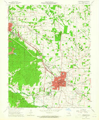
1964 Map of Farmington
USGS Topo · Published 1965About this map
Farmington serves as the focal point of this 1960s study, revealing a well-established civic and institutional landscape in St. Francois County. The town is densely detailed with numerous schools, including Jefferson Sch and St Josephs High Sch, alongside significant public facilities like State Hospital No 4 and the Farmington Airport. The local economy of the mid-20th century is evidenced by Quarries and Mine No 10, while social life is represented by the St Francois Country Club and a Drive-in Theater.
Find a feature on this map
86 named features on this map. Tap any name to fly to it.
Don’t see what you’re looking for? This feature index may not catch every label — zoom into the map to look around manually.
Map Details
Editions of this 1964 Farmington Map
3 editions found
Other maps of this area

1904 · Farmington
USGS Topo · 1:62,500

1905 · Bonneterre
USGS Topo · 1:62,500

1906 · Farmington
USGS Topo · 1:62,500

1937 · Ironton
USGS Topo · 1:48,000

1939 · Fredericktown
USGS Topo · 1:48,000

1945 · Ironton
USGS Topo · 1:62,500

1946 · Ironton
USGS Topo · 1:62,500

1947 · Fredericktown
USGS Topo · 1:62,500

1949 · Rolla
USGS Topo · 1:250,000

1950 · Fredericktown
USGS Topo · 1:62,500