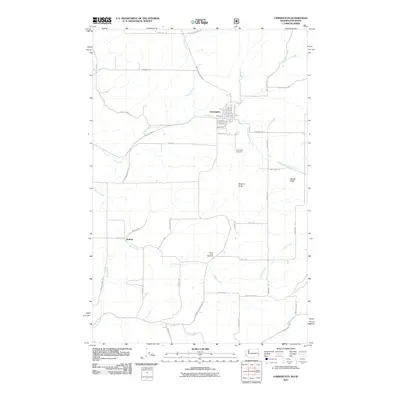
2011 Map of Farmington
USGS Topo · Published 2011About this map
Farmington serves as the primary hub of this eastern Washington landscape, situated where the North Fork Pine Creek and South Fork Pine Creek converge. This 2011 survey reveals a grid-based settlement pattern deeply integrated with the agricultural drainage of Pine Creek and its various tributaries. The town layout is clearly defined by residential streets such as Main St and W Adams St, while Industrial Rd points to the local economic base. To the south and west, the smaller community of Walters is linked by a network of country roads including Walters Rd and McMasters Rd. The terrain is punctuated by prominent rises like Stratton Butte and Palmer Butte, which stand above the surrounding creek valleys. Genealogists will find the locations of Farmington Cemetery and Silver Creek Cemetery valuable for tracing local family histories within Whitman County near the Idaho border.
Find a feature on this map
44 named features on this map. Tap any name to fly to it.
Don’t see what you’re looking for? This feature index may not catch every label — zoom into the map to look around manually.
Map Details
Editions of this 2011 Farmington Map
This is the sole edition of this map. No revisions or reprints were ever made.
Other maps of this area

1903 · Oakesdale
USGS Topo · 1:125,000

1905 · Oakesdale
USGS Topo · 1:125,000

1910 · Pullman
USGS Topo · 1:125,000

1955 · Pullman
USGS Topo · 1:250,000

1955 · Spokane
USGS Topo · 1:250,000

1957 · Tensed
USGS Topo · 1:62,500

1958 · Spokane
USGS Topo · 1:250,000

1958 · Pullman
USGS Topo · 1:250,000

1960 · Potlatch
USGS Topo · 1:62,500

1964 · Oakesdale
USGS Topo · 1:24,000