
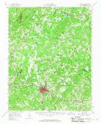
1958 Map of Farmville
USGS Topo · Published 1959About this map
Farmville serves as the primary hub of this 1958 survey, where the Appomattox River and the Norfolk and Western railway intersect. The town's educational and civic character is defined by the presence of Longwood College, the High School, and Moton Sch. To the east, the crossing at High Bridge stands as a significant landmark over the river valley. The surrounding countryside in Prince Edward and Cumberland Counties is densely punctuated with community centers such as Raines Tavern and Guinea Mills, alongside numerous rural houses of worship including Mt Moriah Ch and Sharon Ch.
Find a feature on this map
105 named features on this map. Tap any name to fly to it.
Don’t see what you’re looking for? This feature index may not catch every label — zoom into the map to look around manually.
Map Details
Editions of this 1958 Farmville Map
2 editions found
Other maps of this area

1891 · Palmyra
USGS Topo · 1:125,000

1891 · Farmville
USGS Topo · 1:125,000

1892 · Buckingham
USGS Topo · 1:125,000

1892 · Appomattox
USGS Topo · 1:125,000

1893 · Farmville
USGS Topo · 1:125,000

1895 · Palmyra
USGS Topo · 1:125,000

1897 · Palmyra
USGS Topo · 1:125,000

1947 · Roanoke
USGS Topo · 1:250,000

1950 · Dillwyn
USGS Topo · 1:62,500

1956 · Charlotte Court House
USGS Topo · 1:62,500