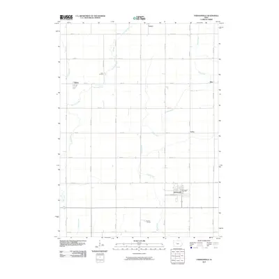
2010 Map of Farnhamville
USGS Topo · Published 2010About this map
Farnhamville anchors this part of Calhoun County, appearing here alongside the Farnhamville Post Office and an organized grid of section roads. The landscape is defined by the winding paths of several waterways, including the meandering Hardin Creek and the eastern and western branches of Cedar Creek. These drainage patterns influenced the placement of early infrastructure and community hubs such as Rinard and Somers. Local history and genealogy interest is concentrated near sites like Cedar Cemetery and Reading Cemetery, which are preserved along the gravel and paved roads. Smaller settlements like Slifer and Easley appear as distinct points within the agricultural expanse, illustrating the dispersed nature of rural Iowa development. The map provides a clear record of the relationship between the township road system, including Valley Ave and Baxter Ave, and the natural creeks that drain the prairie.
Find a feature on this map
32 named features on this map. Tap any name to fly to it.
Don’t see what you’re looking for? This feature index may not catch every label — zoom into the map to look around manually.
Map Details
Editions of this 2010 Farnhamville Map
This is the sole edition of this map. No revisions or reprints were ever made.
Other maps of this area

1954 · Fort Dodge
USGS Topo · 1:250,000

1957 · Fort Dodge
USGS Topo · 1:250,000

1958 · Fort Dodge
USGS Topo · 1:250,000

1962 · Jefferson
USGS Topo · 1:62,500

1965 · Moorland
USGS Topo · 1:24,000

1965 · Farnhamville
USGS Topo · 1:24,000

1965 · Knierim
USGS Topo · 1:24,000

1965 · Gowrie
USGS Topo · 1:24,000

1980 · Wightman
USGS Topo · 1:24,000
1980 · Richard
USGS Topo · 1:24,000