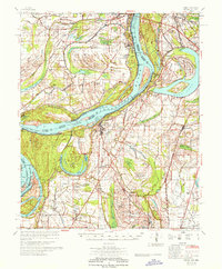
1967 Map of Farrell
USGS Topo · Published 1967About this map
Mississippi River hydrology dominates this mid-century survey, revealing a complex landscape of engineered cut-offs and ancient oxbows along the Arkansas-Mississippi border. The river's historical shifts are visible through features like Horseshoe Lake and the Montezuma Cut-Off, while the fertile Delta soils support a dense network of agricultural estates including Oakhurst Plantation, Iron Plantation, and the King and Anderson Ranch. These large holdings, often marked by private Indian Mounds, reflect the area's deep agrarian and indigenous history.
Find a feature on this map
109 named features on this map. Tap any name to fly to it.
Don’t see what you’re looking for? This feature index may not catch every label — zoom into the map to look around manually.
Map Details
Editions of this 1967 Farrell Map
This is the sole edition of this map. No revisions or reprints were ever made.
Other maps of this area

1908 · Lula
USGS Topo · 1:24,000

1908 · Dundee
USGS Topo · 1:24,000

1908 · Coahoma
USGS Topo · 1:24,000

1908 · Moon Lake
USGS Topo · 1:24,000

1908 · Jonestown
USGS Topo · 1:24,000

1910 · Dundee
USGS Topo · 1:31,680

1910 · Coahoma
USGS Topo · 1:31,680

1910 · Jonestown
USGS Topo · 1:31,680

1912 · Moon Lake
USGS Topo · 1:31,680

1912 · Lula
USGS Topo · 1:31,680