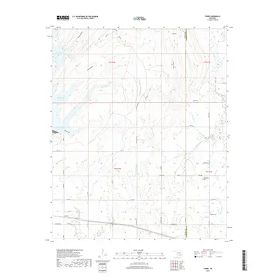
2019 Map of Farris
USGS Topo · Published 2019About this map
The settlement of Farris sits at the intersection of several local routes in this modern survey of the Oklahoma landscape. The western edge is defined by the significant reach of the McGee Creek Reservoir, with its various inlets such as Cat Hollow and Prairie Hollow. This area of Atoka and Pushmataha Counties is characterized by a dense network of watercourses, including Cold Springs Creek, Medicine Branch, and West Sandy Creek, which navigate the undulating terrain near Long Mountain. Local history is anchored by Zoraya Cemetery and Sugarloaf Cemetery, located near Sugarloaf Hill, providing key points of interest for genealogical research in this rural region. The map also traces several section-line roads and named ways like Centerpoint Road, which facilitate travel through Impson Valley and across the county line.
Find a feature on this map
63 named features on this map. Tap any name to fly to it.
Don’t see what you’re looking for? This feature index may not catch every label — zoom into the map to look around manually.
Map Details
Editions of this 2019 Farris Map
This is the sole edition of this map. No revisions or reprints were ever made.
Other maps of this area

1901 · Antlers
USGS Topo · 1:125,000

1912 · Antlers
USGS Topo · 1:125,000

1925 · Antlers
USGS Topo · 1:125,000

1950 · Mcalester
USGS Topo · 1:250,000

1957 · Lane NW
USGS Topo · 1:24,000

1957 · Farris
USGS Topo · 1:24,000

1957 · Moyers
USGS Topo · 1:24,000

1957 · Jumbo
USGS Topo · 1:24,000

1957 · Lane
USGS Topo · 1:24,000

1957 · Lane NE
USGS Topo · 1:24,000