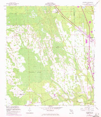
1956 Map of Favoretta
USGS Topo · Published 1972About this map
The dense, low-lying wetlands of Hull Cypress Swamp dominate this landscape along the boundary of Flagler and Volusia counties. This mid-century survey illustrates the corridor of infrastructure cutting through the swampy interior of Florida's east coast. The Florida East Coast Line and the Old Dixie Highway run parallel, connecting small points of settlement like Favoretta (Favorita Sta) and National Gardens.
Find a feature on this map
13 named features on this map. Tap any name to fly to it.
Don’t see what you’re looking for? This feature index may not catch every label — zoom into the map to look around manually.
Map Details
Editions of this 1956 Favoretta Map
5 editions found
Other maps of this area

1937 · Ormond
USGS Topo · 1:48,000

1944 · Ormond
USGS Topo · 1:62,500

1952 · Daytona Beach
USGS Topo · 1:24,000

1954 · Daytona Beach
USGS Topo · 1:250,000

1956 · Favoretta
USGS Topo · 1:24,000

1956 · Flagler Beach East
USGS Topo · 1:24,000

1956 · Flagler Beach West
USGS Topo · 1:24,000

1956 · Ormond Beach
USGS Topo · 1:24,000

1958 · Daytona Beach
USGS Topo · 1:250,000

1962 · Daytona Beach NW
USGS Topo · 1:24,000