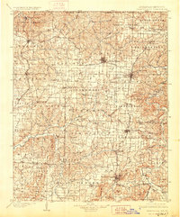
1901 Map of Fayetteville
USGS Topo · Published 1928About this map
Benton and Washington counties in Northwest Arkansas appear here at the turn of the century, dominated by a burgeoning rail network and the clear legacy of the Civil War. In the northeast corner, the Pea Ridge Battlefield sits near Elkhorn Mountain, preserving the site of the 1862 conflict. The regional economy is defined by the St. Louis & San Francisco R.R. and the Kansas City Southern Ry., which connect established towns like Bentonville, Rogers, and Fayetteville.
Find a feature on this map
113 named features on this map. Tap any name to fly to it.
Don’t see what you’re looking for? This feature index may not catch every label — zoom into the map to look around manually.
Map Details
Editions of this 1901 Fayetteville Map
4 editions found
Other maps of this area

1898 · Tahlequah
USGS Topo · 1:125,000

1898 · Winslow
USGS Topo · 1:125,000

1899 · Fayetteville
USGS Topo · 1:125,000

1899 · Siloam Springs
USGS Topo · 1:125,000

1900 · Eureka Springs
USGS Topo · 1:125,000

1901 · Winslow
USGS Topo · 1:125,000

1901 · Eureka Springs
USGS Topo · 1:125,000

1901 · Fayetteville
USGS Topo · 1:125,000

1901 · Tahlequah
USGS Topo · 1:125,000

1903 · Siloam Springs
USGS Topo · 1:125,000