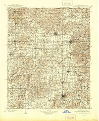
1901 Map of Fayetteville
USGS Topo · Published 1944About this map
Pea Ridge Battlefield sits at the northern edge of this Northwest Arkansas landscape, a site of significant historical weight surveyed just before the turn of the century. The map reveals a robust network of early commerce and transit, with the St Louis & San Francisco RR and Kansas City Southern RR cutting through the plateaus to connect growing hubs like Fayetteville, Bentonville, and Springdale. Outside these centers, the terrain is defined by a deep reliance on the local waterways, including the Illinois River and White River.
Find a feature on this map
132 named features on this map. Tap any name to fly to it.
Don’t see what you’re looking for? This feature index may not catch every label — zoom into the map to look around manually.
Map Details
Editions of this 1901 Fayetteville Map
4 editions found
Other maps of this area

1898 · Tahlequah
USGS Topo · 1:125,000

1898 · Winslow
USGS Topo · 1:125,000

1899 · Fayetteville
USGS Topo · 1:125,000

1899 · Siloam Springs
USGS Topo · 1:125,000

1900 · Eureka Springs
USGS Topo · 1:125,000

1901 · Winslow
USGS Topo · 1:125,000

1901 · Eureka Springs
USGS Topo · 1:125,000

1901 · Fayetteville
USGS Topo · 1:125,000

1901 · Tahlequah
USGS Topo · 1:125,000

1903 · Siloam Springs
USGS Topo · 1:125,000