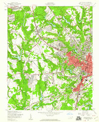
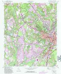
1957 Map of Fayetteville
USGS Topo · Published 1960About this map
Fayetteville anchors this mid-century landscape, appearing as a growing urban hub where residential expansion meets established institutional landmarks. The city's mid-century character is defined by its significant medical and educational infrastructure, including the State Teachers College, Highsmith Hospital, and the Veterans Hospital. To the northwest, the Fort Bragg Military Reservation looms over a series of smaller settlements and community nodes such as Bonnie Doone, Skibo, and Lakedale.
Find a feature on this map
92 named features on this map. Tap any name to fly to it.
Don’t see what you’re looking for? This feature index may not catch every label — zoom into the map to look around manually.
Map Details
Editions of this 1957 Fayetteville Map
5 editions found
Other maps of this area

1948 · Fayetteville
USGS Topo · 1:62,500

1948 · Clifdale
USGS Topo · 1:62,500

1948 · Slocomb
USGS Topo · 1:24,000

1948 · Clifdale
USGS Topo · 1:24,000

1949 · Vander
USGS Topo · 1:24,000

1950 · Clifdale
USGS Topo · 1:24,000

1950 · Fayetteville
USGS Topo · 1:24,000

1950 · Manchester
USGS Topo · 1:24,000

1950 · Slocomb
USGS Topo · 1:24,000

1951 · Clifdale
USGS Topo · 1:62,500