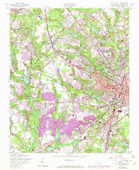
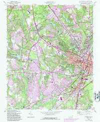
1957 Map of Fayetteville
USGS Topo · Published 1973About this map
Fayetteville serves as the focal point of this mid-century landscape, showcasing the rapid suburban expansion and military influence characterizing Cumberland County. The industrial and transportation corridors of the Southern and Aberdeen and Rockfish railroads define the eastern urban core, while the Fort Bragg Military Reservation looms to the northwest. This period of growth is evident in the transition from established neighborhoods like Haymount and Lakedale to newer developments emerging around Bonnie Doone and Skibo.
Find a feature on this map
60 named features on this map. Tap any name to fly to it.
Don’t see what you’re looking for? This feature index may not catch every label — zoom into the map to look around manually.
Map Details
Editions of this 1957 Fayetteville Map
5 editions found
Other maps of this area

1948 · Fayetteville
USGS Topo · 1:62,500

1948 · Clifdale
USGS Topo · 1:62,500

1948 · Slocomb
USGS Topo · 1:24,000

1948 · Clifdale
USGS Topo · 1:24,000

1949 · Vander
USGS Topo · 1:24,000

1950 · Clifdale
USGS Topo · 1:24,000

1950 · Fayetteville
USGS Topo · 1:24,000

1950 · Manchester
USGS Topo · 1:24,000

1950 · Slocomb
USGS Topo · 1:24,000

1951 · Clifdale
USGS Topo · 1:62,500