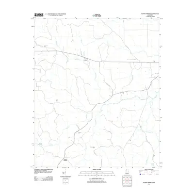
2012 Map of Fearns Springs
USGS Topo · Published 2012About this map
Fearns Springs and Triplets Corners anchor this rural Winston County landscape, characterized by a dense network of creeks and small family cemeteries. The terrain is deeply carved by the headwaters of Blackwater Cr, Hashuqua Cr, and Dancing Rabbit Cr, with Moody Millpond and Dancing Rabbit Springs indicating the historical importance of water resources in this area.
Find a feature on this map
43 named features on this map. Tap any name to fly to it.
Don’t see what you’re looking for? This feature index may not catch every label — zoom into the map to look around manually.
Map Details
Editions of this 2012 Fearns Springs Map
This is the sole edition of this map. No revisions or reprints were ever made.
Other maps of this area

1953 · Meridian
USGS Topo · 1:250,000

1953 · West Point
USGS Topo · 1:250,000

1957 · Meridian
USGS Topo · 1:250,000

1958 · West Point
USGS Topo · 1:250,000

1962 · Vernon
USGS Topo · 1:24,000

1962 · Preston
USGS Topo · 1:24,000

1963 · West Point
USGS Topo · 1:250,000

1963 · Gholson
USGS Topo · 1:24,000

1965 · Meridian
USGS Topo · 1:250,000
1973 · Boon
USGS Topo · 1:24,000