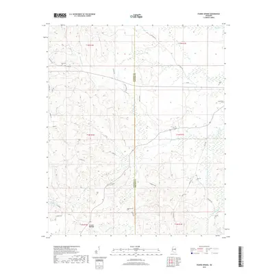
2018 Map of Fearns Springs
USGS Topo · Published 2018About this map
Fearns Springs lies at the intersection of rural routes and waterway history along the boundary of Winston and Noxubee counties. This landscape is defined by the headwaters of Hashuqua Creek and the meandering Dancing Rabbit Cr, a region of significant importance to local history. The map highlights a high density of small family and community burial sites, such as the Choctaw Cem, Mashulaville Cem, and Perkinsville Cem, providing a detailed record for genealogical research. The presence of Dancing Rabbit Springs and the Moody Millpond suggests a long-standing reliance on the local hydrography for both settlement and early industry. Scattered homesteads are connected by a network of named roads including Triplett Store Rd and Mitchell Rd, reflecting the dispersed agricultural character of the area in the late twentieth century.
Find a feature on this map
46 named features on this map. Tap any name to fly to it.
Don’t see what you’re looking for? This feature index may not catch every label — zoom into the map to look around manually.
Map Details
Editions of this 2018 Fearns Springs Map
This is the sole edition of this map. No revisions or reprints were ever made.
Other maps of this area

1953 · Meridian
USGS Topo · 1:250,000

1953 · West Point
USGS Topo · 1:250,000

1957 · Meridian
USGS Topo · 1:250,000

1958 · West Point
USGS Topo · 1:250,000

1962 · Vernon
USGS Topo · 1:24,000

1962 · Preston
USGS Topo · 1:24,000

1963 · West Point
USGS Topo · 1:250,000

1963 · Gholson
USGS Topo · 1:24,000

1965 · Meridian
USGS Topo · 1:250,000
1973 · Boon
USGS Topo · 1:24,000