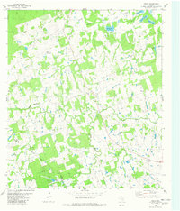
1982 Map of Fedor
USGS Topo · Published 1982About this map
Fedor sits at the heart of this central Texas landscape, characterized by the winding tributaries of the Yegua Creek system. Mapping by the Geological Survey in the early 1980s reveals a rural landscape defined by family-named landmarks and community hubs like Trinity Ch and Hills Point Ch. The terrain is marked by a complex network of seasonal drainages, including Middle Yegua Creek and West Yegua Creek, which feed a series of small water bodies like Lincoln Lake and the somberly named Mourn Lake. In the northern reaches, the map records established family burial grounds such as Wolf Cem and the Melcher Cem, providing essential data for genealogists tracing early settlement patterns in this part of Lee County. The presence of Moab and Mt Nebo Ch further illustrates the localized community structure in a region dominated by ranching and small-scale agriculture.
Find a feature on this map
28 named features on this map. Tap any name to fly to it.
Don’t see what you’re looking for? This feature index may not catch every label — zoom into the map to look around manually.
Map Details
Editions of this 1982 Fedor Map
This is the sole edition of this map. No revisions or reprints were ever made.
Other maps of this area

1885 · Bastrop
USGS Topo · 1:125,000

1893 · Bastrop
USGS Topo · 1:125,000

1904 · Bastrop
USGS Topo · 1:125,000

1919 · Giddings
USGS Topo · 1:62,500

1919 · Dime Box
USGS Topo · 1:62,500

1948 · Smithville
USGS Topo · 1:62,500

1948 · Lexington
USGS Topo · 1:62,500

1950 · Lexington
USGS Topo · 1:62,500

1950 · Smithville
USGS Topo · 1:62,500

1954 · Austin
USGS Topo · 1:250,000