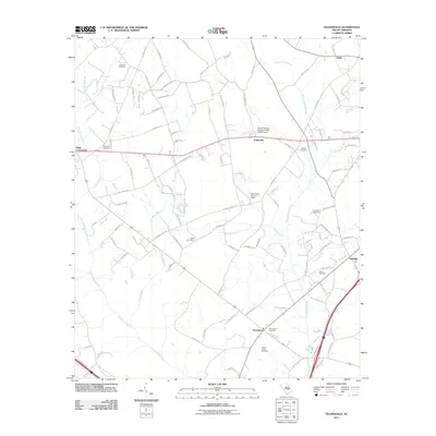
2011 Map of Felderville
USGS Topo · Published 2011About this map
Four Hole Swamp and its winding tributaries, including Bush Branch and Canty Branch, define the low-lying hydrology of this Orangeburg County landscape. The 2011 survey reveals a region characterized by small rural settlements and an extensive network of family and community burial grounds, such as Shuler-Lewis Cemetery and the Island Cemeteries. The settlement pattern centers on historic junctions like Oaks Crossroads and the namesake Felderville, where local roads intersect with US Highway 176 and Interstate 95. In the southern portion, the Providence community is anchored by the Shuler-Lewis Cemetery and Providence Cemetery, illustrating the long-standing genealogical ties of the area. The map also documents modern water management features, including the South Carolina Noname 38030 D-3761 Dam, which interrupts the natural flow toward Providence Swamp.
Find a feature on this map
103 named features on this map. Tap any name to fly to it.
Don’t see what you’re looking for? This feature index may not catch every label — zoom into the map to look around manually.
Map Details
Editions of this 2011 Felderville Map
This is the sole edition of this map. No revisions or reprints were ever made.
Other maps of this area

1920 · Eutawville
USGS Topo · 1:48,000

1920 · Bowman
USGS Topo · 1:48,000

1921 · Bowman
USGS Topo · 1:62,500

1921 · Eutawville
USGS Topo · 1:62,500

1943 · Bowman
USGS Topo · 1:62,500

1943 · Orangeburg
USGS Topo · 1:125,000

1943 · Eutawville
USGS Topo · 1:62,500

1946 · Elloree
USGS Topo · 1:62,500

1954 · Augusta
USGS Topo · 1:250,000

1957 · Augusta
USGS Topo · 1:250,000