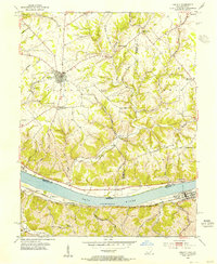
1953 Map of Felicity
USGS Topo · Published 1955About this map
The Ohio River valley serves as the central artery for this 1950s survey, marking the border between Ohio and Kentucky. In the southern half of the map, the Chesapeake and Ohio railroad follows the Kentucky shoreline, connecting the riverfront community of Augusta to nearby Wellsburg and Rock Springs. On the Ohio side, the landscape is defined by the steep, dissected terrain of Shinkles Ridge and the winding course of Bullskin Creek.
Find a feature on this map
50 named features on this map. Tap any name to fly to it.
Don’t see what you’re looking for? This feature index may not catch every label — zoom into the map to look around manually.
Map Details
Editions of this 1953 Felicity Map
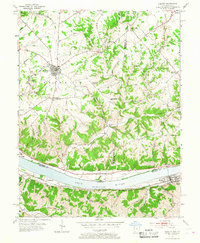
2 editions found
Other maps of this area

1915 · Maysville
USGS Topo · 1:62,500

1919 · Maysville
USGS Topo · 1:62,500

1928 · Higginsport
USGS Topo · 1:48,000

1931 · Felicity
USGS Topo · 1:62,500

1931 · Higginsport
USGS Topo · 1:62,500

1952 · Germantown
USGS Topo · 1:24,000

1952 · Higginsport
USGS Topo · 1:24,000

1952 · Berlin
USGS Topo · 1:24,000

1952 · Brooksville
USGS Topo · 1:24,000

1953 · Laurel
USGS Topo · 1:24,000