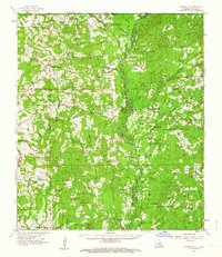
1958 Map of Felixville
USGS Topo · Published 1964About this map
The borderlands of Amite County and St. Helena Parish are defined by a complex network of creeks and bayous in this mid-century survey. Settlement patterns are concentrated around rural post offices and crossroads like Felixville and Woodland. The landscape is heavily wooded, punctuated by timber-related sites like Planer Mills and the Canton Lookout Tower.
Find a feature on this map
92 named features on this map. Tap any name to fly to it.
Don’t see what you’re looking for? This feature index may not catch every label — zoom into the map to look around manually.
Map Details
Editions of this 1958 Felixville Map
4 editions found
Other maps of this area

1906 · Bayou Sara
USGS Topo · 1:125,000

1939 · Zachary
USGS Topo · 1:62,500

1941 · Woodland
USGS Topo · 1:31,680

1941 · Norwood
USGS Topo · 1:31,680

1941 · Gilead
USGS Topo · 1:31,680

1941 · Chipola
USGS Topo · 1:31,680

1942 · Montpelier
USGS Topo · 1:31,680

1942 · Liverpool
USGS Topo · 1:31,680

1942 · Pine Grove
USGS Topo · 1:31,680

1942 · Pride
USGS Topo · 1:31,680