1949 Map of Fellsmere
USGS Topo · Published 1963About this map
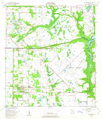
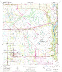
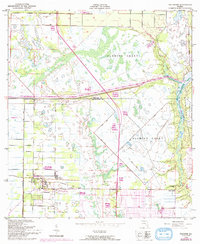
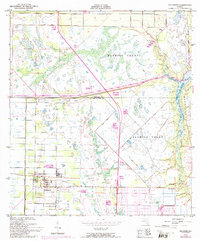
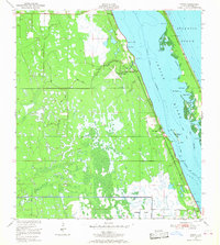
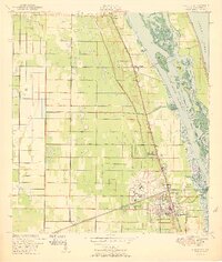
Fellsmere serves as the focal point of this 1949 survey, revealing a landscape defined by organized drainage and early infrastructure at the boundary of Brevard and Indian River Counties. The influence of the Trans Florida Central railroad is evident, providing a vital transport corridor alongside a prominent Telephone Line and irrigation networks marked by numerous spoil banks. These man-made features contrast with the sprawling Fleming Grant and the natural winding paths of the North Prong Sebastian Cr and South Prong. Local history and genealogy interests are well-represented by the Old Sebastian Cem and smaller settlements like Brookside and River Bridge. The presence of the Roseland Airport and a Fish Hatchery further illustrates the varied land use in this part of Florida shortly after the war.
Find a feature on this map
18 named features on this map. Tap any name to fly to it.
Don’t see what you’re looking for? This feature index may not catch every label — zoom into the map to look around manually.
Map Details
Editions of this 1949 Fellsmere Map
5 editions found
Other maps of this area

1949 · Fellsmere
USGS Topo · 1:24,000
1949 · Sebastian NW
USGS Topo · 1:24,000
1949 · Vero Beach
USGS Topo · 1:24,000
1949 · Sebastian
USGS Topo · 1:24,000
1949 · Grant
USGS Topo · 1:24,000
1950 · Vero Beach
USGS Topo · 1:24,000
1951 · Sebastian NW
USGS Topo · 1:24,000
1951 · Fellsmere
USGS Topo · 1:24,000

1951 · Grant
USGS Topo · 1:24,000
1951 · Sebastian
USGS Topo · 1:24,000