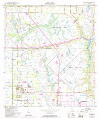
1949 Map of Fellsmere
USGS Topo · Published 1992About this map
The town of Fellsmere serves as the focal point of this coastal Florida landscape, where a grid of early drainage and land development is evident. Set within the historic boundaries of the Fleming Grant, the map details a region transitioning between managed aquaculture and emerging residential tracts. Numerous Fish Hatchery sites are distributed across the terrain, illustrating the local importance of these facilities near the headwaters of the Sebastian River. The hydrological network is dominated by the North Prong and South Prong St Sebastian River, which flow through low-lying areas often reinforced by Spoil Banks. Cultural history is noted at the Old Sebastian Cem and the settlement of Brookside, while the early layout of Vero Lake Estates suggests mid-century suburban expansion. A long Telephone Line and the development around River Bridge reflect the infrastructure of this era.
Find a feature on this map
17 named features on this map. Tap any name to fly to it.
Don’t see what you’re looking for? This feature index may not catch every label — zoom into the map to look around manually.
Map Details
Editions of this 1949 Fellsmere Map
5 editions found
Other maps of this area

1949 · Fellsmere
USGS Topo · 1:24,000

1949 · Sebastian NW
USGS Topo · 1:24,000

1949 · Vero Beach
USGS Topo · 1:24,000

1949 · Sebastian
USGS Topo · 1:24,000

1949 · Grant
USGS Topo · 1:24,000

1950 · Vero Beach
USGS Topo · 1:24,000

1951 · Sebastian NW
USGS Topo · 1:24,000

1951 · Fellsmere
USGS Topo · 1:24,000

1951 · Grant
USGS Topo · 1:24,000

1951 · Sebastian
USGS Topo · 1:24,000