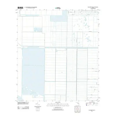
2012 Map of Fellsmere SW
USGS Topo · Published 2012About this map
Blue Cypress Lake anchors the southwestern corner of this coastal Florida landscape, where the natural water systems meet a highly engineered grid of agricultural and residential development. The territory is defined by long, straight drainage canals and access roads that reflect the area's history of land reclamation and farming. This 2012 survey shows the geometric layout of the Fellsmere Farm Rd corridor, where large-scale field patterns dominate the central terrain. To the north and east, more compact residential street grids appear, with equestrian-themed names like Stallion St, Buckskin St, and Deer Run Rd indicating the suburban transition of the rural landscape. This map captures the intersection of Florida's expansive wetland edges and the systematic subdivision of the interior.
Find a feature on this map
17 named features on this map. Tap any name to fly to it.
Don’t see what you’re looking for? This feature index may not catch every label — zoom into the map to look around manually.
Map Details
Editions of this 2012 Fellsmere SW Map
This is the sole edition of this map. No revisions or reprints were ever made.
Other maps of this area

1949 · Fellsmere
USGS Topo · 1:24,000

1949 · Grant
USGS Topo · 1:24,000

1951 · Fellsmere
USGS Topo · 1:24,000

1951 · Grant
USGS Topo · 1:24,000

1953 · Fellsmere SW
USGS Topo · 1:24,000

1953 · Fellsmere NW
USGS Topo · 1:24,000

1953 · Fort Drum NE
USGS Topo · 1:24,000

1953 · Kenansville NE
USGS Topo · 1:24,000

1953 · Kenansville SE
USGS Topo · 1:24,000

1953 · Fellsmere 4 NW
USGS Topo · 1:24,000