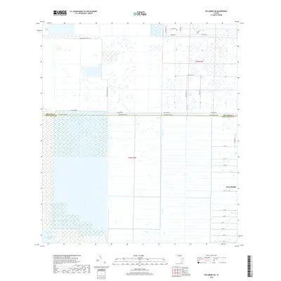
2018 Map of Fellsmere SW
USGS Topo · Published 2018About this map
Saint Johns Marsh dominates the northern expanse of this landscape where the boundaries of Brevard and Indian River counties meet. This region is defined by an intricate network of drainage and conservation efforts, evidenced by the long, straight reaches of Fellsmere Grade Rd and T M Goodwin Rd that cut across the wetlands. To the southwest, the waters of Blue Cypress Lake touch the edge of the survey, while the eastern margin shows the residential expansion of Fellsmere with its numbered grid, including 101st St and 85th St. The area reflects a contemporary balance between agricultural land use, rural residential development along named paths like Broken Well Ln, and environmental preservation, highlighted by the presence of the Florida Bird Viewing Trl winding through the marshland.
Find a feature on this map
27 named features on this map. Tap any name to fly to it.
Don’t see what you’re looking for? This feature index may not catch every label — zoom into the map to look around manually.
Map Details
Editions of this 2018 Fellsmere SW Map
This is the sole edition of this map. No revisions or reprints were ever made.
Other maps of this area

1949 · Fellsmere
USGS Topo · 1:24,000

1949 · Grant
USGS Topo · 1:24,000

1951 · Fellsmere
USGS Topo · 1:24,000

1951 · Grant
USGS Topo · 1:24,000

1953 · Fellsmere SW
USGS Topo · 1:24,000

1953 · Fellsmere NW
USGS Topo · 1:24,000

1953 · Fort Drum NE
USGS Topo · 1:24,000

1953 · Kenansville NE
USGS Topo · 1:24,000

1953 · Kenansville SE
USGS Topo · 1:24,000

1953 · Fellsmere 4 NW
USGS Topo · 1:24,000