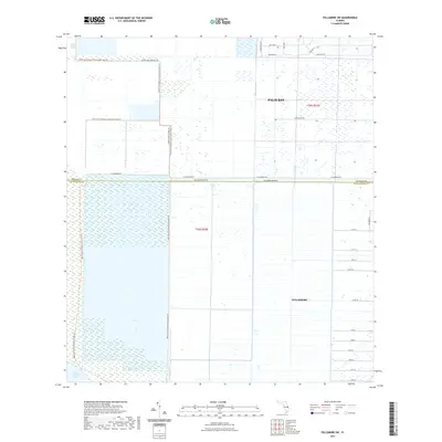
2021 Map of Fellsmere SW
USGS Topo · Published 2021About this map
The vast wetlands of the Atlantic coastal interior define this area on the border of Brevard and Indian River counties. Palm Bay occupies the northeastern reaches, where residential street grids like Stallion St and Cavalier St begin to push into the marshlands. To the south, the city of Fellsmere is mapped with its characteristic numbered street system, including 115th St and 101st St, demonstrating the region's structured expansion.
Find a feature on this map
28 named features on this map. Tap any name to fly to it.
Don’t see what you’re looking for? This feature index may not catch every label — zoom into the map to look around manually.
Map Details
Editions of this 2021 Fellsmere SW Map
This is the sole edition of this map. No revisions or reprints were ever made.
Other maps of this area

1949 · Fellsmere
USGS Topo · 1:24,000

1949 · Grant
USGS Topo · 1:24,000

1951 · Fellsmere
USGS Topo · 1:24,000

1951 · Grant
USGS Topo · 1:24,000

1953 · Fellsmere SW
USGS Topo · 1:24,000

1953 · Fellsmere NW
USGS Topo · 1:24,000

1953 · Fort Drum NE
USGS Topo · 1:24,000

1953 · Kenansville NE
USGS Topo · 1:24,000

1953 · Kenansville SE
USGS Topo · 1:24,000

1953 · Fellsmere 4 NW
USGS Topo · 1:24,000