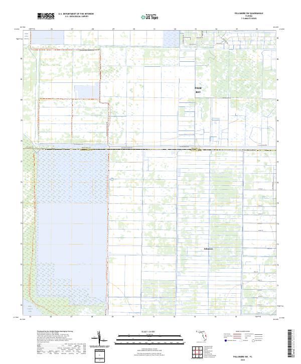
2024 Map of Fellsmere SW
USGS Topo · Published 2024About this map
The Saint Johns Marsh and Blue Cypress Lake dominate this landscape on the border of Brevard and Indian River counties. This area is defined by massive water management and conservation efforts, as seen in the extensive canal networks and the Three Forks Marsh Conservation Area Trl. The map illustrates a transition from the southern outskirts of Palm Bay into the systematic drainage and agricultural grid of Fellsmere.
Find a feature on this map
33 named features on this map. Tap any name to fly to it.
Don’t see what you’re looking for? This feature index may not catch every label — zoom into the map to look around manually.
Map Details
Editions of this 2024 Fellsmere SW Map
This is the sole edition of this map. No revisions or reprints were ever made.
Other maps of this area

1949 · Fellsmere
USGS Topo · 1:24,000

1949 · Grant
USGS Topo · 1:24,000

1951 · Fellsmere
USGS Topo · 1:24,000

1951 · Grant
USGS Topo · 1:24,000

1953 · Fellsmere SW
USGS Topo · 1:24,000

1953 · Fellsmere NW
USGS Topo · 1:24,000

1953 · Fort Drum NE
USGS Topo · 1:24,000

1953 · Kenansville NE
USGS Topo · 1:24,000

1953 · Kenansville SE
USGS Topo · 1:24,000

1953 · Fellsmere 4 NW
USGS Topo · 1:24,000