
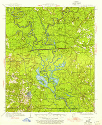
1934 Map of Felsenthal
USGS Topo · Published 1954About this map
Grand Marais and the surrounding bottomlands of the Ouachita River dominate this 1930s landscape at the Arkansas-Louisiana border. The town of Felsenthal serves as a key point near the confluence of the Ouachita and the Saline River, while Huttig appears as a significant developed center to the southwest. The region's economy is clearly tied to the timber industry, evidenced by the extensive network of the Logging RR branching through the swampy terrain near Lapoile Creek.
Find a feature on this map
90 named features on this map. Tap any name to fly to it.
Don’t see what you’re looking for? This feature index may not catch every label — zoom into the map to look around manually.
Map Details
Editions of this 1934 Felsenthal Map
2 editions found
Other maps of this area

1933 · Strong
USGS Topo · 1:62,500

1934 · Ingalls
USGS Topo · 1:48,000

1934 · Moro Bay
USGS Topo · 1:62,500

1935 · Naff
USGS Topo · 1:62,500

1935 · Haile
USGS Topo · 1:62,500

1937 · Strong
USGS Topo · 1:62,500

1937 · Felsenthal
USGS Topo · 1:62,500

1937 · Ingalls
USGS Topo · 1:62,500

1938 · Felsenthal
USGS Topo · 1:62,500

1938 · Moro Bay
USGS Topo · 1:62,500