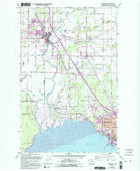
1952 Map of Ferndale
USGS Topo · Published 1994About this map
The Nooksack River meanders toward Bellingham Bay in this mid-century survey, revised with late-century developments. The landscape is defined by the transition from the agricultural river valley to the industrial and suburban growth of Bellingham. In the west, the Lummi Indian Reservation occupies the coastal lowlands, featuring the Lummi Tribal Sch and Northwest Indian College near Smuggler Slough.
Find a feature on this map
70 named features on this map. Tap any name to fly to it.
Don’t see what you’re looking for? This feature index may not catch every label — zoom into the map to look around manually.
Map Details
Editions of this 1952 Ferndale Map
4 editions found
Other maps of this area

1906 · Sumas
USGS Topo · 1:62,500

1907 · Blaine
USGS Topo · 1:62,500

1908 · Sumas
USGS Topo · 1:62,500

1918 · Samish Lake
USGS Topo · 1:62,500

1943 · Anacortes
USGS Topo · 1:62,500

1951 · Anacortes
USGS Topo · 1:62,500

1952 · Bertrand Creek
USGS Topo · 1:24,000

1952 · Lynden
USGS Topo · 1:24,000

1952 · Ferndale
USGS Topo · 1:24,000

1952 · Lummi Bay
USGS Topo · 1:24,000