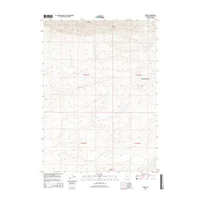
2015 Map of Ferris
USGS Topo · Published 2015About this map
The Ferris Mountains dominate the northern landscape of this Carbon County quadrangle, where the high ridges give way to Miners Canyon and several seasonal drainage systems. The settlement pattern is defined by isolated outposts like McCargar Place, reached by a network of dirt routes including Ferris Rd and Buzzard Rd. The hydrology of the area is characterized by intermittent flows such as Sand Cr and Turkey Cr in the north, while the southern reaches contain Stone Cr and Riddle Cr. The presence of Rinshaw Lake and the prominent Table Mtn highlight a region shaped by high-altitude ranching and mining history, where early 21st-century topography remains largely untouched by modern development.
Find a feature on this map
15 named features on this map. Tap any name to fly to it.
Don’t see what you’re looking for? This feature index may not catch every label — zoom into the map to look around manually.
Map Details
Editions of this 2015 Ferris Map
This is the sole edition of this map. No revisions or reprints were ever made.
Other maps of this area

1953 · Bradley Peak
USGS Topo · 1:24,000

1953 · Wild Horse Mountain
USGS Topo · 1:24,000

1953 · Ferris
USGS Topo · 1:24,000

1953 · Buzzard Ranch
USGS Topo · 1:24,000

1953 · Spanish Mine
USGS Topo · 1:24,000

1953 · Riddle Cut
USGS Topo · 1:24,000

1955 · Casper
USGS Topo · 1:250,000

1958 · Casper
USGS Topo · 1:250,000

1960 · Boggy Meadows
USGS Topo · 1:24,000

1961 · Lamont NE
USGS Topo · 1:24,000