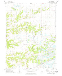
1974 Map of Fiatt
USGS Topo · Published 1978About this map
The unincorporated community of Fiatt serves as a central point in this mid-1970s landscape, where the agricultural traditions of Deerfield and Joshua townships meet the rising influence of heavy industry. The map captures a significant environmental transition, with extensive Strip Mined Areas in the north and south contrasting against the natural drainage of Turkey Creek and Lost Grove Creek.
Find a feature on this map
21 named features on this map. Tap any name to fly to it.
Don’t see what you’re looking for? This feature index may not catch every label — zoom into the map to look around manually.
Map Details
Editions of this 1974 Fiatt Map
This is the sole edition of this map. No revisions or reprints were ever made.
Other maps of this area

1912 · Canton
USGS Topo · 1:62,500

1915 · Avon
USGS Topo · 1:62,500

1918 · Vermont
USGS Topo · 1:62,500

1921 · Vermont
USGS Topo · 1:62,500

1925 · Havana
USGS Topo · 1:62,500

1944 · Avon
USGS Topo · 1:62,500

1947 · Lewistown
USGS Topo · 1:24,000

1947 · St. David
USGS Topo · 1:24,000

1948 · Lewistown
USGS Topo · 1:24,000
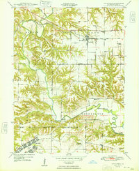
1948 · Smithfield
USGS Topo · 1:24,000