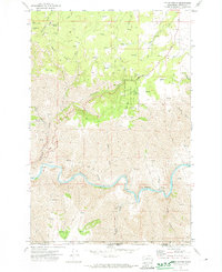
1971 Map of Fields Spring
USGS Topo · Published 1974About this map
The Grande Ronde River carves a deep, winding path through the borderlands of Washington and Oregon, defining the dramatic topography of this 1971 survey. The landscape is characterized by steep ridges and canyons, including Box Canyon and Deep Canyon, where elevation drops sharply toward the riverbank. This area is home to Fields Spring State Park and portions of the Umatilla National Forest, highlighting the region's character as a managed wilderness at the start of the 1970s.
Find a feature on this map
34 named features on this map. Tap any name to fly to it.
Don’t see what you’re looking for? This feature index may not catch every label — zoom into the map to look around manually.
Map Details
Editions of this 1971 Fields Spring Map
2 editions found
Other maps of this area

1943 · Saddle Butte
USGS Topo · 1:62,500

1944 · Anatone
USGS Topo · 1:62,500

1946 · Saddle Butte
USGS Topo · 1:62,500

1946 · Anatone
USGS Topo · 1:62,500

1955 · Pullman
USGS Topo · 1:250,000

1955 · Grangeville
USGS Topo · 1:250,000

1958 · Pullman
USGS Topo · 1:250,000

1959 · Grangeville
USGS Topo · 1:250,000
1967 · Paradise
USGS Topo · 1:24,000
1967 · Teepee Butte
USGS Topo · 1:24,000