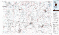
1986 Map of Findlay
USGS Topo · Published 1986About this map
Findlay and the surrounding agricultural plains of Northwest Ohio are defined by an extensive network of waterways and railroads in the mid-1980s. The landscape is bisected by major rail lines including Conrail, the Baltimore And Ohio, and the Norfolk And Western, which converge at industrial hubs like Fostoria and Tiffin. These transport corridors mirror the natural drainage patterns of the Blanchard River and the complex branches of the Portage River. Conservation and managed lands are visible across the quadrangle, from the Maumee State Forest in the northwest to the Springville Marsh State Natural Area in the southeast. Smaller settlements like North Baltimore, McComb, and Bloomdale serve as local anchors within the gridded township system, while the Ohio Turnpike provides a high-speed bypass through the northern reaches near Bowling Green.
Find a feature on this map
96 named features on this map. Tap any name to fly to it.
Don’t see what you’re looking for? This feature index may not catch every label — zoom into the map to look around manually.
Map Details
Editions of this 1986 Findlay Map
2 editions found
Other maps of this area

1900 · Maumee Bay
USGS Topo · 1:62,500

1900 · Toledo
USGS Topo · 1:62,500

1900 · Oak Harbor
USGS Topo · 1:62,500

1901 · Put-In-Bay
USGS Topo · 1:62,500

1901 · Bellevue
USGS Topo · 1:62,500

1901 · Fostoria
USGS Topo · 1:62,500

1901 · Bowling Green
USGS Topo · 1:62,500

1901 · Fremont
USGS Topo · 1:62,500

1901 · Elmore
USGS Topo · 1:62,500

1903 · Bellevue
USGS Topo · 1:62,500