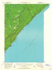
1956 Map of Finland
USGS Topo · Published 1963About this map
Lake Superior dominates the eastern half of this mid-century survey, its coastline marked by dramatic landforms such as Palisade Head and Shovel Point. The interior is defined by the heavy timber of the Finland State Forest and Crystal Bay State Forest, where the topography is dissected by the Baptism River and its various branches. At the time of this mapping, the region was a mix of conservation land, nascent tourism, and Cold War defense, evidenced by the presence of the Finland Air Force Station near Finland. Along the lake shore, small outposts like Illgen City, Little Marais, and Kennedy Landing provide evidence of early coastal settlement. Local landmarks such as the Community Hall and Finland Cem offer specific points of interest for those researching the community's mid-twentieth-century development.
Find a feature on this map
52 named features on this map. Tap any name to fly to it.
Don’t see what you’re looking for? This feature index may not catch every label — zoom into the map to look around manually.
Map Details
Editions of this 1956 Finland Map
2 editions found
Other maps of this area

1954 · Silver Bay
USGS Topo · 1:62,500

1954 · Two Harbors
USGS Topo · 1:250,000

1955 · Schroeder
USGS Topo · 1:24,000

1955 · Tofte
USGS Topo · 1:62,500

1955 · Isabella
USGS Topo · 1:62,500

1955 · Cramer
USGS Topo · 1:62,500

1956 · Little Marais
USGS Topo · 1:24,000

1956 · Finland
USGS Topo · 1:24,000

1956 · Finland
USGS Topo · 1:62,500

1956 · Illgen City
USGS Topo · 1:24,000