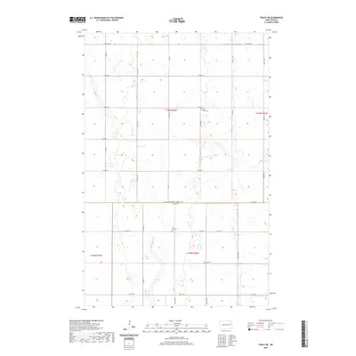
2020 Map of Finley NE
USGS Topo · Published 2020About this map
The Grand Forks Co Steele Co line bisects this agricultural landscape, where the headwaters of Beaver Cr meander through a series of prairie potholes and wetlands. The settlement pattern is defined by the Public Land Survey System, with a rigid grid of gravel roads like Co Rd 16 and Co Hwy 16 providing access to isolated farmsteads and rural landmarks. Three distinct burial grounds serve as anchor points for local genealogy, including West Union Cem in the north and the aptly named Silent Hill Cem further south. This 2020 edition documents a contemporary view of the Red River Valley's upland margins, preserving the locations of family cemeteries like Hoff Cem that remain vital links to the region's Scandinavian and pioneer heritage.
Find a feature on this map
29 named features on this map. Tap any name to fly to it.
Don’t see what you’re looking for? This feature index may not catch every label — zoom into the map to look around manually.
Map Details
Editions of this 2020 Finley NE Map
This is the sole edition of this map. No revisions or reprints were ever made.
Other maps of this area

1936 · Larimore
USGS Topo · 1:62,500

1939 · Niagara
USGS Topo · 1:62,500

1952 · Grand Forks
USGS Topo · 1:250,000

1956 · Grand Forks
USGS Topo · 1:250,000

1963 · Niagara SW
USGS Topo · 1:24,000

1963 · Larimore SW
USGS Topo · 1:24,000

1963 · Logan Center
USGS Topo · 1:24,000

1966 · Grand Forks
USGS Topo · 1:250,000

1967 · Finley NE
USGS Topo · 1:24,000

1967 · Finley
USGS Topo · 1:24,000