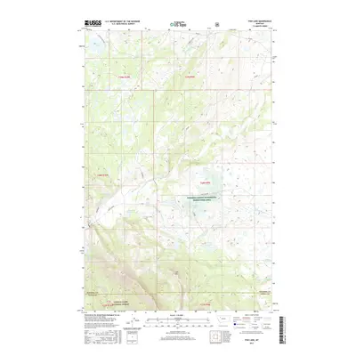
2017 Map of Fish Lake
USGS Topo · Published 2017About this map
The Pondera County Waterfowl Production Area occupies a central portion of this landscape, characterized by an intricate cluster of glacial pothole lakes and wetlands. Water bodies such as Cody Lake, Howes Lakes, and Waddel Lakes dot the terrain, providing critical habitat within this conservation zone. To the west, the topography rises sharply as the boundary of the Lewis & Clark National Forest is reached, marked by the prominent peak of Split Mtn.
Find a feature on this map
35 named features on this map. Tap any name to fly to it.
Don’t see what you’re looking for? This feature index may not catch every label — zoom into the map to look around manually.
Map Details
Editions of this 2017 Fish Lake Map
This is the sole edition of this map. No revisions or reprints were ever made.
Other maps of this area

1914 · Heart Butte
USGS Topo · 1:125,000

1918 · Heart Butte
USGS Topo · 1:125,000

1960 · Cut Bank
USGS Topo · 1:250,000

1963 · Cut Bank
USGS Topo · 1:250,000

1964 · Cut Bank
USGS Topo · 1:250,000

1968 · Swift Reservoir
USGS Topo · 1:24,000
1968 · Gateway Pass
USGS Topo · 1:24,000

1968 · Fish Lake
USGS Topo · 1:24,000
1968 · Scoffin Butte
USGS Topo · 1:24,000
1968 · Volcano Reef
USGS Topo · 1:24,000