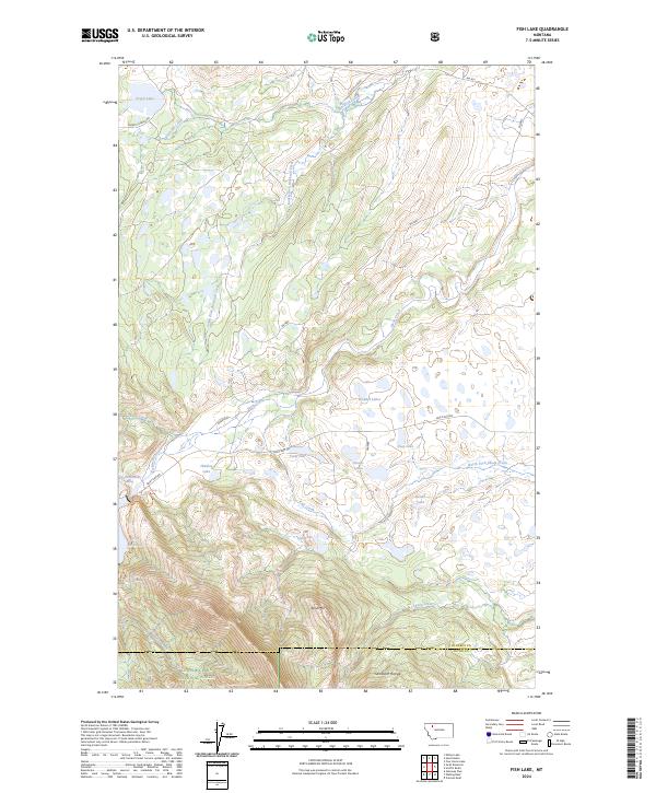
2024 Map of Fish Lake
USGS Topo · Published 2024About this map
The Sawtooth Range dominates the southern reaches of this landscape, where the Bob Marshall Wilderness and Lewis & Clark National Forest meet. This terrain is defined by its complex hydrology, centered on the Swift Reservoir and the drainage systems of Birch Creek and Fish Creek. A notable conservation feature is the Pondera County Waterfowl Production Area, which encompasses several small water bodies including Deep Lake and the Howes Lakes. The map illustrates a high-altitude environment with significant peaks like Split Mtn and remote water features such as Green Lake and Fish Lake. Road access is limited to gravel routes like Swift Dam Rd and Mowitch Basin Rd, reflecting the area's role as a protected wilderness and managed wildlife habitat along the Pondera and Teton County border.
Find a feature on this map
39 named features on this map. Tap any name to fly to it.
Don’t see what you’re looking for? This feature index may not catch every label — zoom into the map to look around manually.
Map Details
Editions of this 2024 Fish Lake Map
This is the sole edition of this map. No revisions or reprints were ever made.
Other maps of this area

1914 · Heart Butte
USGS Topo · 1:125,000

1918 · Heart Butte
USGS Topo · 1:125,000

1960 · Cut Bank
USGS Topo · 1:250,000

1963 · Cut Bank
USGS Topo · 1:250,000

1964 · Cut Bank
USGS Topo · 1:250,000

1968 · Swift Reservoir
USGS Topo · 1:24,000
1968 · Gateway Pass
USGS Topo · 1:24,000

1968 · Fish Lake
USGS Topo · 1:24,000
1968 · Scoffin Butte
USGS Topo · 1:24,000
1968 · Volcano Reef
USGS Topo · 1:24,000