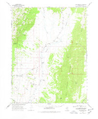
1968 Map of Fish Springs
USGS Topo · Published 1978About this map
Little Fish Lake Valley serves as the central corridor of this Nye County landscape, bounded by the Monitor Range and the Hot Creek Range. In the late 1960s, the area remained largely undeveloped, characterized by isolated water sources like Fish Springs and Sevenmile Spring that supported livestock and local transit. The presence of Clear Creek Ranch and a prospect near Stargo Spring indicates the traditional ranching and mineral exploration patterns of central Nevada.
Find a feature on this map
35 named features on this map. Tap any name to fly to it.
Don’t see what you’re looking for? This feature index may not catch every label — zoom into the map to look around manually.
Map Details
Editions of this 1968 Fish Springs Map
2 editions found

Other maps of this area

1926 · Roberts Mountains
USGS Topo · 1:250,000

1929 · Roberts Mountains
USGS Topo · 1:250,000

1955 · Millett
USGS Topo · 1:250,000

1956 · Cockalorum Wash
USGS Topo · 1:62,500

1956 · Horse Heaven Mtn
USGS Topo · 1:62,500

1956 · Tonopah
USGS Topo · 1:250,000

1959 · Tonopah
USGS Topo · 1:250,000

1959 · Millett
USGS Topo · 1:250,000

1960 · Dianas Punch Bowl
USGS Topo · 1:62,500

1962 · Tonopah
USGS Topo · 1:250,000