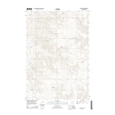
2014 Map of Fisher Butte
USGS Topo · Published 2014About this map
Fisher Butte rises above an intricate network of seasonal drainages and named springs in the Birney District of Rosebud County. This 2014 survey illustrates the complex watershed of the region, where tributaries like Lame Deer Cr and S Fork Alderson Cr carve through the landscape. The distribution of water sources is particularly noteworthy, with Crazy Head Spring, White Horse Spring, Spang Spring, and Station Spring positioned across the terrain. These landmarks often represent critical water points for local cattle ranching and land management in this part of Montana. Transportation through the area is defined by Birney RD and Highway 4, which follow the natural contours of the gulches and creek beds. From Soldier Gulch in the north to the headwaters of Tie Cr in the south, the map provides a precise layout of the modern rural infrastructure and natural hydrology of the Northern Cheyenne Indian Reservation vicinity.
Find a feature on this map
32 named features on this map. Tap any name to fly to it.
Don’t see what you’re looking for? This feature index may not catch every label — zoom into the map to look around manually.
Map Details
Editions of this 2014 Fisher Butte Map
This is the sole edition of this map. No revisions or reprints were ever made.
Other maps of this area

1954 · Hardin
USGS Topo · 1:250,000

1957 · Hardin
USGS Topo · 1:250,000

1958 · Hardin
USGS Topo · 1:250,000

1958 · Garfield Peak
USGS Topo · 1:24,000

1958 · Jimtown
USGS Topo · 1:24,000

1958 · Fisher Butte
USGS Topo · 1:24,000

1958 · Lame Deer
USGS Topo · 1:24,000

1958 · Badger Peak
USGS Topo · 1:24,000

1958 · Hollowwood Creek
USGS Topo · 1:24,000

1966 · Birney Day School
USGS Topo · 1:24,000