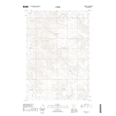
2020 Map of Fisher Butte
USGS Topo · Published 2020About this map
Fisher Butte stands as a prominent landmark in this Rosebud County landscape, surrounded by an intricate drainage system including White Buffalo Cr and Broken Jaw Cr. The terrain is defined by its numerous water sources, such as Spang Spring, White Horse Spring, and Station Spring, which appear throughout the various gulches. The drainage patterns of Crazy Head Fork and S Fork Lame Deer Cr provide insight into the natural flow of the region's hydrography. Connectivity is maintained through a network of secondary roads including Soldier Gulch Rd and Birney Rd, which navigate the elevation changes around Soldier Gulch and Standing Elk Cr. This survey illustrates the modern configuration of range lands and watersheds before the more recent developments in the eastern Montana plains.
Find a feature on this map
31 named features on this map. Tap any name to fly to it.
Don’t see what you’re looking for? This feature index may not catch every label — zoom into the map to look around manually.
Map Details
Editions of this 2020 Fisher Butte Map
This is the sole edition of this map. No revisions or reprints were ever made.
Other maps of this area

1954 · Hardin
USGS Topo · 1:250,000

1957 · Hardin
USGS Topo · 1:250,000

1958 · Hardin
USGS Topo · 1:250,000

1958 · Garfield Peak
USGS Topo · 1:24,000

1958 · Jimtown
USGS Topo · 1:24,000

1958 · Fisher Butte
USGS Topo · 1:24,000

1958 · Lame Deer
USGS Topo · 1:24,000

1958 · Badger Peak
USGS Topo · 1:24,000

1958 · Hollowwood Creek
USGS Topo · 1:24,000

1966 · Birney Day School
USGS Topo · 1:24,000