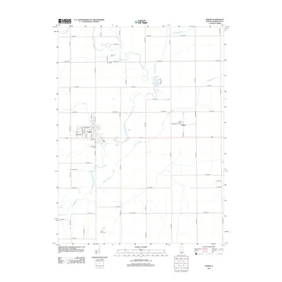
2012 Map of Fisher
USGS Topo · Published 2012About this map
The Sangamon River meanders through the central Illinois prairie, anchoring this survey of the landscape surrounding Fisher. The town's grid is well-defined north of Green St, centered on thoroughfares like W Sangamon St and S 3rd St. East of the main settlement, the village of Dewey sits along Railroad St, serving as a smaller hub in this agricultural region. The map reveals a high density of ancestral burial grounds, including Willowbrook Cem just south of Fisher, Beekman Cem at the river's northern bend, and the isolated Knife Stout Cem near the southern boundary.
Find a feature on this map
56 named features on this map. Tap any name to fly to it.
Don’t see what you’re looking for? This feature index may not catch every label — zoom into the map to look around manually.
Map Details
Editions of this 2012 Fisher Map
This is the sole edition of this map. No revisions or reprints were ever made.
Other maps of this area

1906 · Urbana
USGS Topo · 1:62,500

1907 · Mahomet
USGS Topo · 1:62,500

1924 · Paxton
USGS Topo · 1:62,500

1927 · Paxton
USGS Topo · 1:62,500

1928 · Gibson City
USGS Topo · 1:62,500

1949 · Paxton
USGS Topo · 1:62,500

1957 · Urbana
USGS Topo · 1:62,500

1957 · Paxton
USGS Topo · 1:62,500

1957 · Gibson City
USGS Topo · 1:62,500

1957 · Rising
USGS Topo · 1:24,000