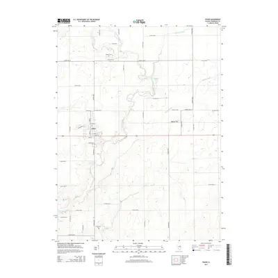
2015 Map of Fisher
USGS Topo · Published 2015About this map
The village of Fisher anchors this study of northern Champaign County, situated at the intersection of a well-defined grid of township roads and the Sangamon River valley. This 2015 update illustrates how contemporary transportation patterns follow historic corridors, such as the path of US Route 136 passing through the center of town. Further east, the smaller settlement of Dewey sits amid an expansive agricultural landscape marked by sophisticated drainage networks like Wildcat Slough and Big Ditch, which were essential for transforming the region's prairie into productive farmland.
Find a feature on this map
41 named features on this map. Tap any name to fly to it.
Don’t see what you’re looking for? This feature index may not catch every label — zoom into the map to look around manually.
Map Details
Editions of this 2015 Fisher Map
This is the sole edition of this map. No revisions or reprints were ever made.
Other maps of this area

1906 · Urbana
USGS Topo · 1:62,500

1907 · Mahomet
USGS Topo · 1:62,500

1924 · Paxton
USGS Topo · 1:62,500

1927 · Paxton
USGS Topo · 1:62,500

1928 · Gibson City
USGS Topo · 1:62,500

1949 · Paxton
USGS Topo · 1:62,500

1957 · Urbana
USGS Topo · 1:62,500

1957 · Paxton
USGS Topo · 1:62,500

1957 · Gibson City
USGS Topo · 1:62,500

1957 · Rising
USGS Topo · 1:24,000