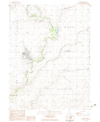
1983 Map of Fisher
USGS Topo · Published 1983About this map
The Sangamon River meanders across this Central Illinois landscape, defining the character of the Brown, East Bend, and Newcomb townships. This early 1980s provisional record captures the village of Fisher as a primary local hub, where the Illinois Central Gulf railroad line meets the residential grid and local High Sch. The surrounding agricultural lands are crisscrossed by drainage features like Wildcat Slough, Robertson Slough, and the channelized Big Ditch, illustrating the intensive water management necessary for prairie farming.
Find a feature on this map
26 named features on this map. Tap any name to fly to it.
Don’t see what you’re looking for? This feature index may not catch every label — zoom into the map to look around manually.
Map Details
Editions of this 1983 Fisher Map
This is the sole edition of this map. No revisions or reprints were ever made.
Other maps of this area

1906 · Urbana
USGS Topo · 1:62,500

1907 · Mahomet
USGS Topo · 1:62,500

1924 · Paxton
USGS Topo · 1:62,500

1927 · Paxton
USGS Topo · 1:62,500

1928 · Gibson City
USGS Topo · 1:62,500

1949 · Paxton
USGS Topo · 1:62,500

1957 · Urbana
USGS Topo · 1:62,500

1957 · Paxton
USGS Topo · 1:62,500

1957 · Gibson City
USGS Topo · 1:62,500

1957 · Rising
USGS Topo · 1:24,000