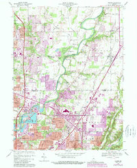
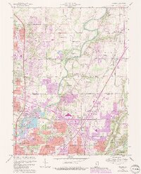
1967 Map of Fishers
USGS Topo · Published 1988About this map
The White River and its various tributaries, including Cool Creek and Mud Creek, define the transition from agrarian landscape to suburban expansion during the late 1960s. This document highlights the development of several residential neighborhoods such as New Briton, Castleton, and Allisonville, contrasted against the preserved grounds of the Conner Prairie Museum and the Oaklawn Memorial Gardens (Cemetery). To the south, the edge of the Fort Benjamin Harrison Mil Res and the Indianapolis Metropolitan Airport represent the major institutional and infrastructure footprints of the era.
Find a feature on this map
72 named features on this map. Tap any name to fly to it.
Don’t see what you’re looking for? This feature index may not catch every label — zoom into the map to look around manually.
Map Details
Editions of this 1967 Fishers Map
5 editions found
Other maps of this area

1948 · Indianapolis East
USGS Topo · 1:24,000

1948 · Indianapolis West
USGS Topo · 1:24,000

1952 · Cumberland
USGS Topo · 1:24,000

1952 · Fishers
USGS Topo · 1:24,000

1952 · Carmel
USGS Topo · 1:24,000

1952 · Mc Cordsville
USGS Topo · 1:24,000

1953 · Westfield
USGS Topo · 1:24,000

1953 · Riverwood
USGS Topo · 1:24,000

1953 · Noblesville
USGS Topo · 1:24,000

1953 · Cincinnati
USGS Topo · 1:250,000