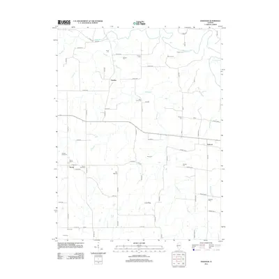
2012 Map of Fishhook
USGS Topo · Published 2012About this map
McKee Cr and its tributaries, including Fishhook Cr and Lanes Br, carve through this rural landscape on the border of Adams and Pike Counties. The map reveals a high density of small burial grounds that reflect the area's deep family roots, such as the Mixer Family Cem and Mayfield Family Cem. Local topography is punctuated by prominent features like The Mound and Long Ridge, which overlook the dispersed settlements of Fishhook, Chestline, and Beverly.
Find a feature on this map
77 named features on this map. Tap any name to fly to it.
Don’t see what you’re looking for? This feature index may not catch every label — zoom into the map to look around manually.
Map Details
Editions of this 2012 Fishhook Map
This is the sole edition of this map. No revisions or reprints were ever made.
Other maps of this area

1925 · Liberty
USGS Topo · 1:62,500

1926 · Pittsfield
USGS Topo · 1:62,500

1926 · Mt Sterling
USGS Topo · 1:62,500

1927 · Liberty
USGS Topo · 1:62,500

1929 · Mt Sterling
USGS Topo · 1:62,500

1931 · Barry
USGS Topo · 1:62,500

1936 · Barry
USGS Topo · 1:48,000

1944 · Barry
USGS Topo · 1:62,500

1948 · Quincy
USGS Topo · 1:250,000

1956 · Quincy
USGS Topo · 1:250,000