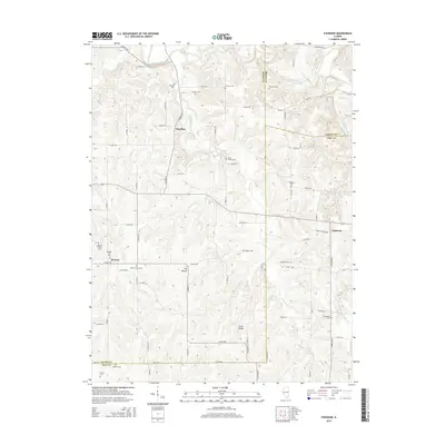
2015 Map of Fishhook
USGS Topo · Published 2015About this map
The crossroads of Beverly and Chestline sit within a landscape of deeply incised stream valleys and prominent high points on this 2015 study. In the western portion of the map, The Mound rises as a distinct landmark near Mound Prairie Cem, while Long Ridge extends through the southern section. The terrain is defined by the drainage of McKee Creek and its many tributaries, including Lanes Br, Grindstone Cr, and Fishhook Cr. This area, where Adams, Brown, and Pike counties meet, is densely populated with family burial grounds and community resting places, such as the Mixer Family Cem, Fairview Cem, and Beverly Old Cem. These small, scattered sites provide a clear picture of the rural settlement patterns and genealogical heritage of this part of West Central Illinois, where small hamlets like Fishhook remain connected by a network of township roads.
Find a feature on this map
71 named features on this map. Tap any name to fly to it.
Don’t see what you’re looking for? This feature index may not catch every label — zoom into the map to look around manually.
Map Details
Editions of this 2015 Fishhook Map
This is the sole edition of this map. No revisions or reprints were ever made.
Other maps of this area

1925 · Liberty
USGS Topo · 1:62,500

1926 · Pittsfield
USGS Topo · 1:62,500

1926 · Mt Sterling
USGS Topo · 1:62,500

1927 · Liberty
USGS Topo · 1:62,500

1929 · Mt Sterling
USGS Topo · 1:62,500

1931 · Barry
USGS Topo · 1:62,500

1936 · Barry
USGS Topo · 1:48,000

1944 · Barry
USGS Topo · 1:62,500

1948 · Quincy
USGS Topo · 1:250,000

1956 · Quincy
USGS Topo · 1:250,000