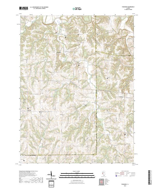
2024 Map of Fishhook
USGS Topo · Published 2024About this map
The borderlands of Adams, Brown, and Pike Counties converge in this rural Illinois landscape, where small rural centers like Beverly and Chestline serve as anchors for a network of local roads. The terrain is defined by the drainage of the Middle Fork McKee Creek, which carves through the undulating topography south of Long Ridge. Prominent geographical features such as The Mound provide a distinct sense of place in this agricultural region, where the land is divided into a classic grid of sections and township roads.
Find a feature on this map
65 named features on this map. Tap any name to fly to it.
Don’t see what you’re looking for? This feature index may not catch every label — zoom into the map to look around manually.
Map Details
Editions of this 2024 Fishhook Map
This is the sole edition of this map. No revisions or reprints were ever made.
Other maps of this area

1925 · Liberty
USGS Topo · 1:62,500

1926 · Pittsfield
USGS Topo · 1:62,500

1926 · Mt Sterling
USGS Topo · 1:62,500

1927 · Liberty
USGS Topo · 1:62,500

1929 · Mt Sterling
USGS Topo · 1:62,500

1931 · Barry
USGS Topo · 1:62,500

1936 · Barry
USGS Topo · 1:48,000

1944 · Barry
USGS Topo · 1:62,500

1948 · Quincy
USGS Topo · 1:250,000

1956 · Quincy
USGS Topo · 1:250,000